From the plains to the peaks
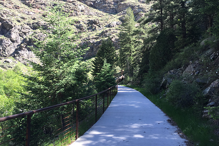 Last week I had the opportunity to check out a section of the Peaks to Plains Trail, a ‘16 in 2016′ trail, with Project Manager Scot Grossman. The 4-mile section that we toured straddles the border of Jefferson and Clear Creek Counties and is set to open in mid-July. The ultimate vision for the Peaks to Plains Trail stretches from the Continental Divide at the Eisenhower Tunnel to the confluence of the South Platte River in Adams County.
Connecting trails
We have many, many excellent multi-use trails scattered across our state, but to create a bike network in Colorado these trails must be connected. Several projects are in the works that will make it possible to travel long distances almost entirely off-street.
Peaks to Plains is one such project. Large sections of the proposed 65-mile trail exist already in the form of the Clear Creek Trail, Silver Plume to Georgetown Express Trail and Bakerville to Loveland Trail, but a large section is missing.
Biking is banned along US 6 between US 93 and the juncture with I-70 (at Kermitts Corner) because of safety concerns related to the many narrow tunnels that dot the highway. So, years ago, Clear Creek County Open Space and Jeffco Open Space began to envision a trail through the canyon. As you can imagine, it’s a huge undertaking, so the trail is being worked on in sections.
This is an overview of the whole vision for the Peaks to Plains Trail and its connection to the Continental Divide to Glenwood Springs bike route:
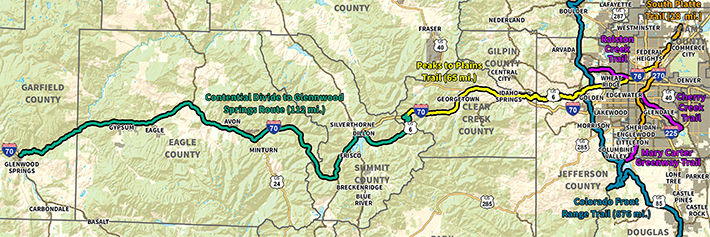
Zooming in a bit, the 16.5 mile segment through the Clear Creek Canyon is called out:

Trail segment opening soon!
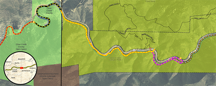
Zooming in further, this is the stretch of trail that is being worked on now. The black/yellow and orange/yellow segments are nearly complete and will be opening in mid-July, while the pink/yellow segment is under construction and is scheduled to open next summer.
Great Outdoors Colorado funding was instrumental in making this project a reality, and Jeffco Open Space and Clear Creek County Open Space are actively applying for grant funding for additional segments of trail that will make up the 16.5 miles through Clear Creek Canyon.
When it opens in mid-July, this portion of the trail will be accessible from several parking lots, including the Mayhem Gulch trail head at the east end. It will be a unique experience to ride, walk or cross country ski through the canyon, next to the rushing Clear Creek and separated from auto traffic.
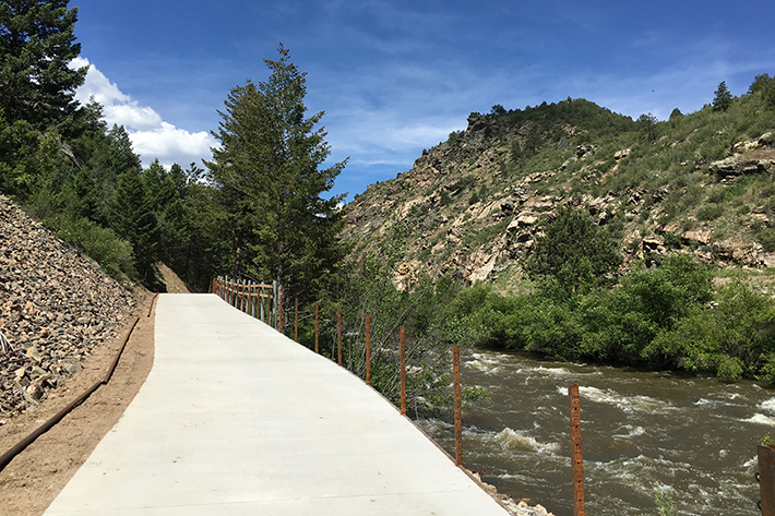
The trail crosses the creek on three bridges. Check out this video of crews installing the bridges.
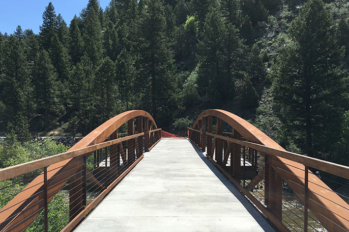
Prior to opening, the concrete will be stained to blend in with the natural surroundings.
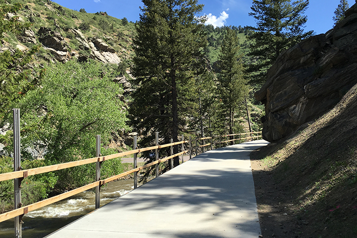
There are beautiful views from the bridges across the creek.
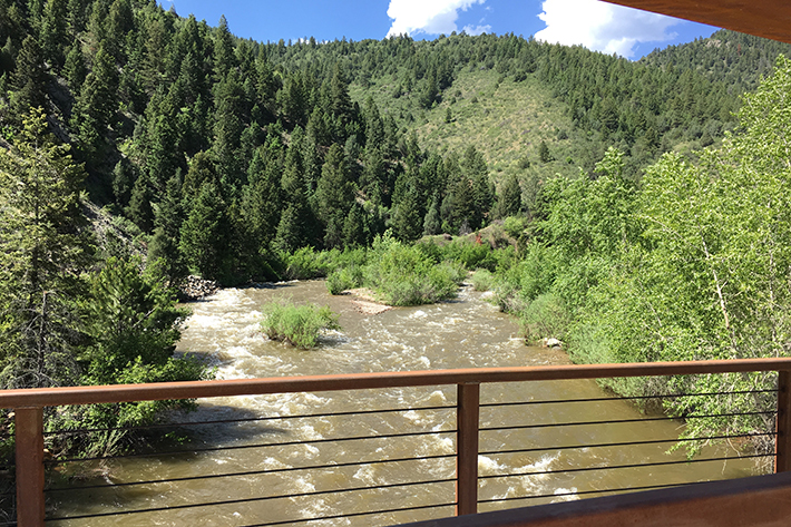
Railings were designed to reflect the area’s mining heritage and are being constructed from naturally-weathering steel.
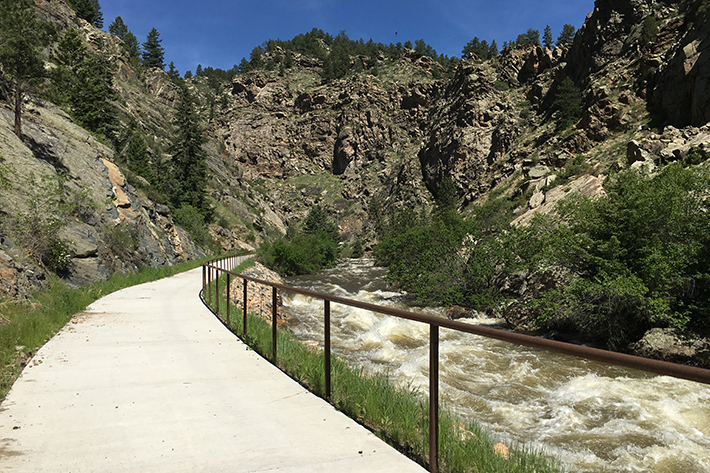
Along many parts of the trail, you’d never know that auto traffic is close by.
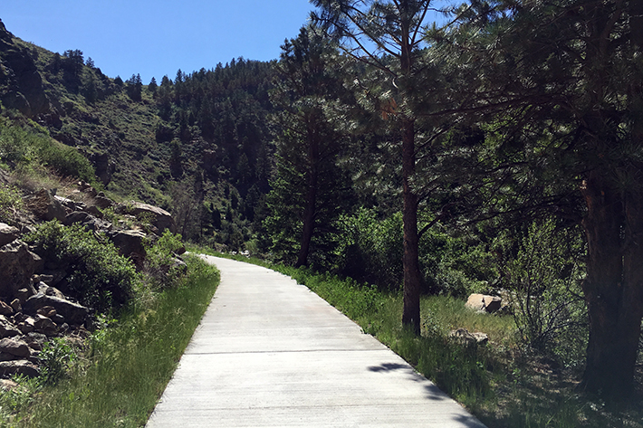
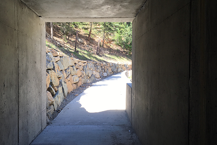
The trail meanders up over bridges and down through this tunnel.
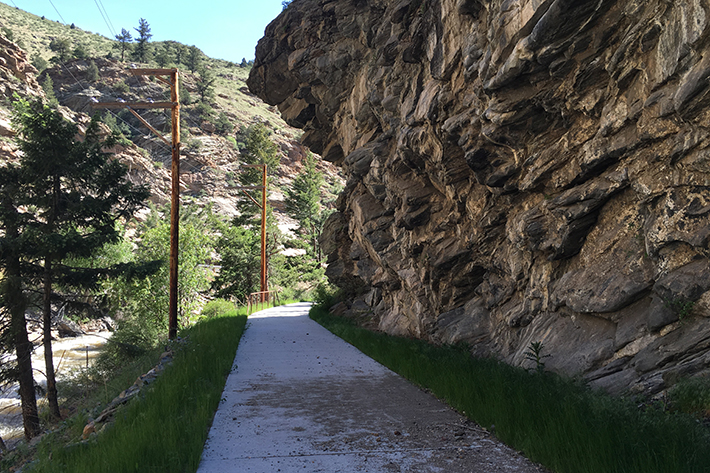
Here’s a really interesting section where rock overhangs the trail.
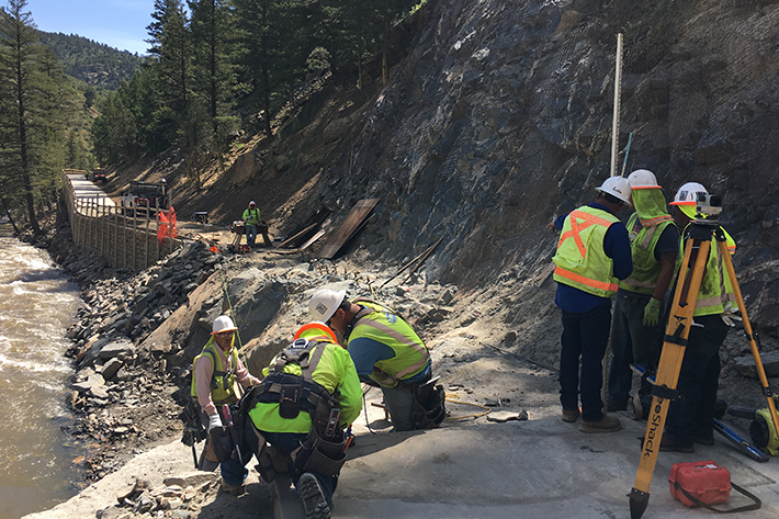
The construction crew is hard at work on the final pieces of trail. Until the trail is officially opened, it is a closed construction site.
Multi-use trails drive tourism and economic development
This section of trail is beautiful and it will be a joy to ride, but the larger vision is also cause for celebration.
Imagine being a tourist in Colorado, stepping off a plane at DIA, putting your bike together and exploring from Denver to the mountains and beyond using only your bike on safe, beautiful infrastructure. Or you could complete the trip with a combination of bike, train and/or bus. How incredibly cool would that be?
The Peaks to Plains Trail has the potential to be a major tourism driver for our state, and I’m excited to see this vision begin to come to fruition!
Leave A COMMENT
Our twitter feed is unavailable right now.


COMMENTS (24)
Kaylyn B. -
Of the 16.5 miles through Clear Creek Canyon, how many miles will be opening this year and how many miles will be opening next year?
Katie Bonomo -
Hi, Kaylyn! Three miles will be opening this year and about one mile will be opening next year. Jeffco and Clear Creek are working to put together funding for the rest.
Margo -
Do you know if there are nearby camping spots? It would be so fun to spend a week or two biking or camping this route once it’s finished.
Katie Bonomo -
Great idea! That would be fun. I haven’t looked into camping accessibility much, but here are some options in Clear Creek and Jefferson Counties: http://clearcreekcounty.org/camp/ http://jeffco.us/open-space/activities/camping/
Isabel -
the map is not that clear. Is the route going to be open from Golden west this July or is that section the part that opens next year?
Katie Bonomo -
Hi, Isabel. The black/yellow and orange/yellow segments in the third map will be opening in mid-July and the pink/yellow segment next summer. These ~4 miles will not connect to other sections of trail when they open. They are in the middle of the canyon and are accessible from trail heads along the canyon. Future sections of trail will connect these sections to other trails. Hope that helps!
Chris -
Thank you for the write-up. I’ve been excited for years about this, and am looking forward to riding it soon. Hopefully they can secure more funding soon and continue the vision.
Katie Bonomo -
Thanks, Chris. I’m looking forward to riding it too!
MileHighBuck -
Fabulous article, thank you. I have long thought Bicycle Colorado should have an updated web page highlighting various projects in Colorado and their status. For instance, 1) status of bike path between I-70 Genesee Park exit & Bergen Park, 2) status of bridge over Clear Creek to Fall River Road (again to avoid having to ride on I-70), and 3) Guanella Pass paving (I actually know this is now complete to Grant on #285, but how many riders do?). I’m sure there are many more that other biking enthusiasts have questions about. Again, thanks.
Katie Bonomo -
Thanks! I love that idea. Since there are always many projects going on across the state and we have a fairly small staff, I’m not sure we could dedicate the resources that a page like that would require just yet, but our staff is growing and it’s definitely something we’ll consider for the future!
Peech -
Do you know why they built a 4 mile isolated section that connects to nothing instead of starting at one end or the other of Clear Creek Canyon where it is accessible to bicycles? It doesn’t make sense to me to drive a distance to ride a 4 mile out and back.It concerns me that they started in the middle and may not secure funding for the connectors needed.
Katie Bonomo -
Hi Peech, that’s a great question. I’m not sure all of the reasons that this section was chosen as the first, but I believe one reason is that it allowed Jefferson County and Clear Creek County to work together to figure out how to navigate the challenging task of building a trail through the canyon. The trail straddles the county line. The project team is very committed to finding funding to connect the trail all the way through the canyon, and one of the next sections they’re planning to work on will connect to the west end of the Clear Creek Trail in Golden.
ChipB -
This is great news and so excited to ride it! Speaking of possible trial connections, has there ever been talk of a trail connecting Golden and Boulder? Its always seemed odd to me that there is no safe, easy option to ride between two of the greatest biking communities in the country that are so close to one another, yet tons of open space that could be used for it. I’m sure it would be one of the most popular trails in the area.
Katie Bonomo -
Hi, Chip. It has been talked about. The plans for a Front Range Trail would connect Golden and Boulder. Here’s the original plan: http://cpw.state.co.us/Documents/Trails/LWCF/CFRT/CFRTWebMap25.pdf
Trailsnet -
Hi Katie – Thanks for the great article. This is going to be such a great trail when it’s done!!!
Katie Bonomo -
Thanks, Trailsnet! Agree!
Herb -
Has the state or county concerns developed a plan on how to connect US 6 and I-70? My concern is how they are going to put a trail around or through the many traffic tunnels. Also where are funds coming from to maintain the trail?
Katie Bonomo -
Hi, Herb. I don’t believe that specific plans have been created yet for how trails will connect at the junction of US 6 and I-70. Jeffco Open Space and Clear Creek Open Space are maintaining the sections of this trail that run through their jurisdictions, but I’m not sure what funding sources they’re using. Jeffco and Clear Creek would be able to answer that question for you. Thanks!
Gary Brower -
Hi Katie!
Good to see this work!
Is there a master map that shows what is ALREADY built, and where there are gaps? The pdf linked above doesn’t provide enough detail, and the screen shots you’ve provided aren’t on it.
Thanks!
Gary
Katie Bonomo -
Hi, Gary. This may be what you’re looking for: https://cdnr.us/#/trail/trail6
Fred Wert -
Katie,
Do you know why concrete is being used? Do you the cost per mile for design, engineering, and construction? Thanks.
Katie Bonomo -
Hi, Fred. I don’t know those details, but Jeffco Open Space would be the group to contact for that. Thanks!
Jim Loud -
I’m very pleased that the Denver area has another bike trail in the works. Unfortunately these biking assets are 5 hours from my part of Colorado. Are there any plans for bike asserts in the more remote (and poorer) areas of the state? I thought that these under served areas, especially Scenic Byways, were a CDOT priority.
Katie Bonomo -
Thanks for your comment, Jim! The Peaks to Plains Trail is one of 16 highest priority trail projects that the governor has identified for 2016. Check out https://cdnr.us/#/cothebeautiful to learn more about the other projects all across the state. Also, if you’ll email me at katie@bicyclecolorado.org and let me know where you live I can give you some more information on projects that are in the works for your area of the state.