Route finding by bike about to get easier in Jefferson County
You know that frustration. You’re out on a ride getting some miles in or just on a Sunday stroll with some pals. You reach a point on the route or trail and it’s suddenly and abundantly unclear how and where the route continues. No signs, no pavement markings, nobody to follow or ask. You hope your smartphone has coverage.
You’ve just experienced what’s clinically defined as Lack of Wayfinding Fatigue or LWF. Whether you’ve personally suffered from LWF or know someone who has, there is some good news. Jefferson County (the fourth largest county in Colorado) just completed the JeffCo Regional Bikeways Wayfinding Guide (October 2016). The guide “serves as the toolkit for the development of a regional wayfinding network. When implemented, the wayfinding signs will be a core component of the well-used, more intuitively navigable, and memorable JeffCo Regional Bikeway network.”
Basically, new signs are coming to popular routes that will make it much easier for residents and visitors alike to navigate.
Making it Easier to Navigate
Why is this good news? Based on conversations I’ve had over the years, we’re woefully short on bicycle and pedestrian wayfinding in JeffCo (and other Colorado counties). In looking at tools to encourage more walking and biking across ages and abilities, wayfinding is an important one.
Good wayfinding that makes routes obvious and destinations clear can take most–or all–of the guesswork out of a bike ride or walk no matter where you are headed: the business district, the library, the park, the grocery store, the rec center, or to a friend’s house. We hope these new signs will encourage more people to go by bike and simply make it easier for those who already do.
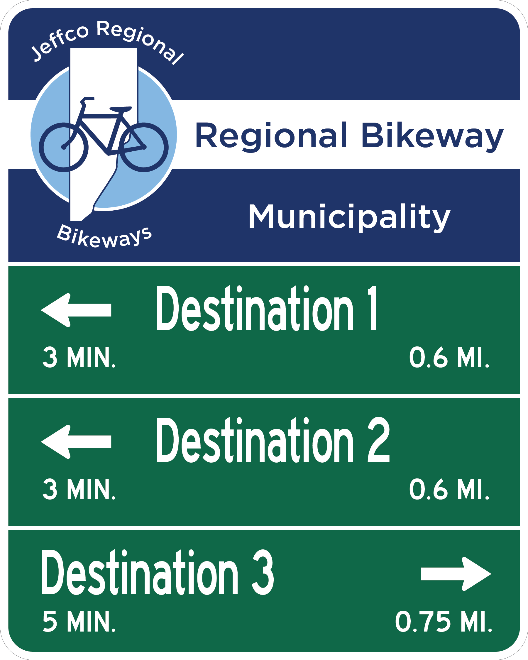
A sample decision sign (as included in the plan) is shown at right. Wouldn’t a network of these on prioritized routes make walking and biking easier and more enjoyable? We think so.
Where to From Here?
Signs will be installed during the spring and summer months of 2017 on the Central Bikeway Route: a 20-mile route that runs between C-470 in the south (Highlands Ranch area) and 100th Avenue in the north (Westminster). The two other top priority routes are 32nd street from Golden to Denver, and a route following the RTD light rail’s W Line, also between Golden and Denver. Those will be fully signed in the months and years after Central Bikeway is completed. Dive into the plan to see all of the routes identified as needing signage in JeffCo.
Thanks!
Kudos to the consultant team that provided the technical expertise on the project, including Alta Planning & Design; OV Consulting; and Fox, Tuttle and Hernandez Transportation Group. Also, hats off to all of the municipal staff that have been engaged from the beginning to help develop a good plan with a steady eye on implementation.
We are excited for what’s in play next year and hope other Colorado counties will learn from this and seek to replicate it. Way to go, JeffCo!
Leave A COMMENT
Our twitter feed is unavailable right now.


